
Search all our Collections
Our Main Collections
Archaeology Art Arthur Conan Doyle Beer, breweries, and licensed premises Books, libraries, and publishing Children's books Crime, detection, and the law Crime fiction Fantastic fiction Language and linguistics Literary studies Local history Military history Modern literature Myth and legend Natural history Occult P. G. Wodehouse Paranormal Philosophy Poetry Religion Scottish local history Sherlock Holmes Signed, associated, and limited editions Transport Wines and spirits
Maps and mapping
This collections includes maps and books about map-makers or map-making.
21 items found
Displaying: 1-21

Text book on topographical and geographical surveying
His Majesty's Stationery Office
1925
A comprehensive guide to surveying. From the library of noted cartographer John Bartholomew.
The maps of Edinburgh 1544-1929
Edinburgh Public Libraries
1932
A revised edition of Cowan's catalogue which originally appeared in The Book of the Old Edinburgh Club.
Soviet Russia in maps: its origins and development
George Philip & Son, Ltd.
1942
Provides maps for the whole Union and maps of European Russia on a larger scale.

The globe and its uses
George Philip & Son, Ltd.
1936
An instruction manual on the application of the globe in understanding the earth and its place in the solar system.
The world map in Hereford Cathedral
Friends of Hereford Cathedral
1979
A guide to the Mappa Mundi with a separate discussion of the pictures.
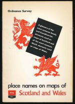
Place names on maps of Scotland and Wales.
Ordnance Survey
1969
A glossary of the most common Gaelic, Scandinavian and Welsh elements used on maps.
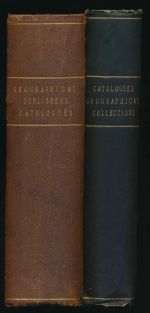
Catalogues of maps, geographical publications, and exhibitions
Various
1874-1887
A collection of 24 catalogues from Britain, Spain, Russia, Belgium, France, Holland and Germany, with a loosely laid in letter from the firm of Edward Stanford, and other loosely laid in material. From the library of noted cartographer John George Bartholomew.
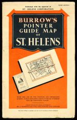
Burrow's pointer guide map of St. Helens
Ed. J. Burrow & Co. Ltd.
1950s
Published with the approval of St. Helen's Corporation.
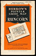
Burrow's pointer guide map of Runcorn
Ed. J. Burrow & Co. Ltd.
1950s
Published with the approval of the Urban District Council.
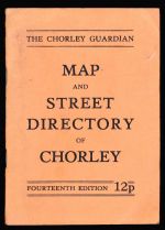
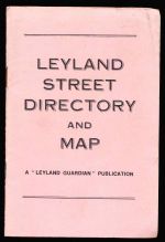
Map and street directory of Chorley
Chorley Guardian
1970s
A guide to locations in Chorley.
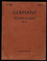
Germany town plans. No. 2
War Office
1944
n atlas of German town maps for use during the liberation of Germany. Marked 'Restricted'.
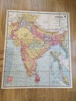
India
W. & A.K. Johnston, Limited
1880s
A political map of India, in colour, with inset of Burma.
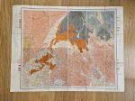
Geological survey of Great Britain LXXIIN
Ordnance Survey
1867
A map of the geology of the potteries, in colour. Retailed by Edward Stanford.
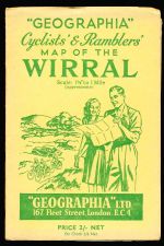
Cyclists' and ramblers' map of the Wirral
Geographia Ltd.
1960s
A guide to the roads of the Wirral.
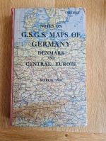
Notes on G.S.G.S. maps of Germany, Denmark and Central Europe
War Office, Directorate of Military Survey
1944
An introduction to maps available for military personnel covering Germany, Denmark, Austria Czechoslovakia, and Poland. Marked Secret.
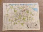
Edinburgh transport map
City of Edinburgh Transport Department
1953
A map od Edinburgh showing the tram, bus, and coach routes, with adverts on the back.
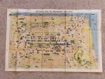
Pictorial map of Edinburgh
Geo. A. Reid
1935
A map showing the principal buildings and places of interest in Edinburgh, with biographical notes of famous people on the back.
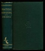
Practical surveying: a text-book for students preparing for examinations for survey work in the colonies
Crosby Lockwood and Son
1911
A detailed scientific treatise on land surveying and engineering, with specific consideration of colonial regulations.
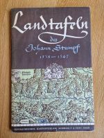
Landkarten des Johann Stumpf, 1538-1547
Geographischer Karten-Verlag Kummerly & Frey
1942
A facsimile edition of twelve maps, originally published in 1552.
